
| Home » Gregor » Travel » In Flight |
|
In
Flight
|
| Flying at 35,000 feet offers some unique views of our environment. Thanks to digital photo post-processing we can see contrast and detail-rich images taken through double pane Plexiglas windows. |
|
|
|
|
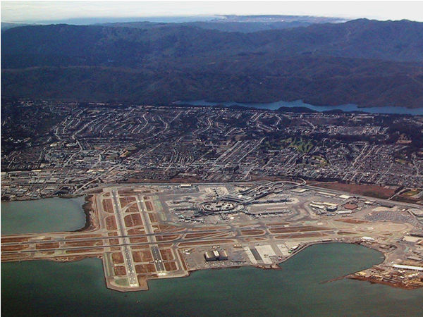
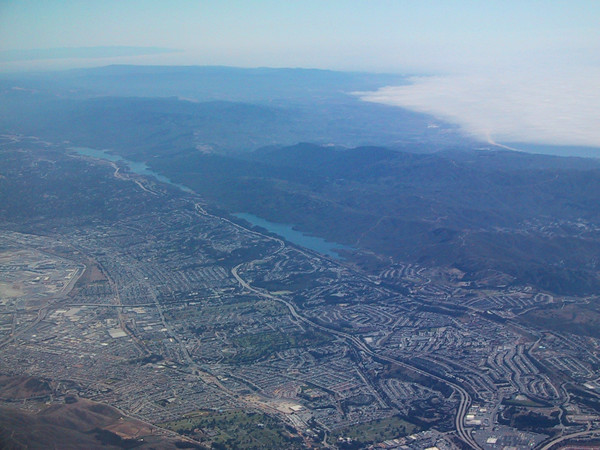
| San Francisco International Airport (SFO) is built on top of landfill into the San Francisco Bay. In the background we see Crystal Springs reservoir which marks the San Andreas fault line. | Point Reyes, just 30 miles north of San Francisco covered in coastal fog. Fog covers the San Francisco coast in summer when humid air meets cold ocean currents. | The Crystal Springs reservoirs are shaped along the fault line, next to the Santa Cruz mountains. Scenic highway 280 affords a stellar view of the reservoirs and fog 'spilling' over the hills. |
|
|
|
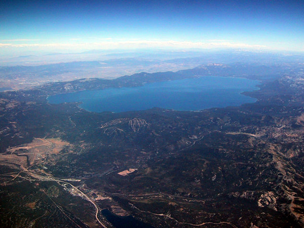
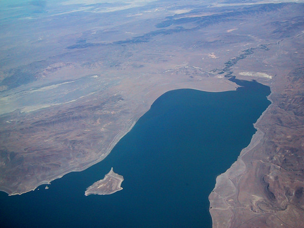
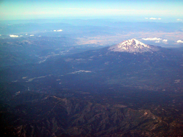
| 22 miles long and 12 miles wide, Lake Tahoe in the Sierra Nevadas is easily spotted from the plane. At 1645 ft deep, it is the 3rd deepest and one of the cleanest lakes in the US. Lake Tahoe has a single outlet, the Truckee river. | Pyramid Lake in Nevada. The Truckee River flows from Lake Tahoe to the Pyramid Lake to evaporate in the desert -- Pyramid Lake has no outlet. The water from Lake Tahoe never reaches the ocean. The tiny island at the bottom left of the picture is the tufa rock formation that gave the lake its name. | Unidentified peak on the West Coast. |
|
|
|
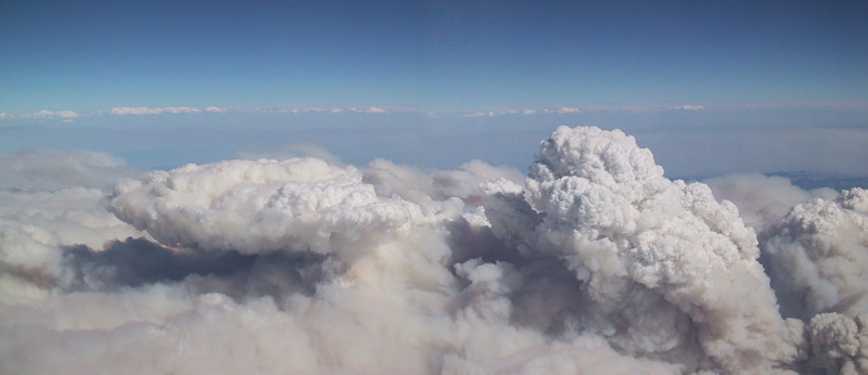
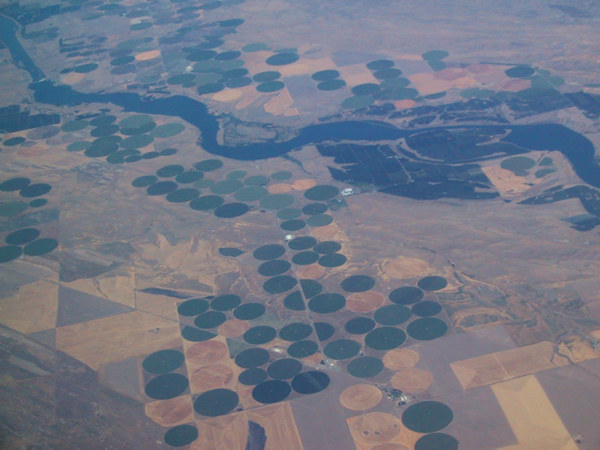
| Devastating forest fires in Idaho and Montana create smoke clouds 30,000 feet into the sky. The plane had to change course in order to avoid the smoke. | Irrigation in the Mid West creates farmland in form of circles. | |
| . | ||
|
|
|
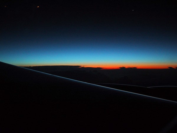
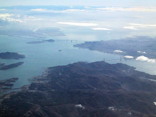
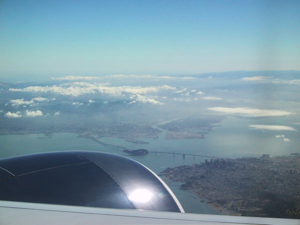
| Northern sunrise on the flight from San Francisco to London. | View over the San Francisco Bay on approach to SFO. In the front the Golden Gate bridge, on the horizon Treasure Island and the Bay Bridge. | Downtown San Francisco and the Bay Bridge from a Boeing 777. |